
We’ve had some rather fine weather across the United Kingdom this week with little in the way of rainfall thanks to high pressure being dominant. That will change during the next few days as we see low pressure moving out of the near continent and pushing into southern areas.
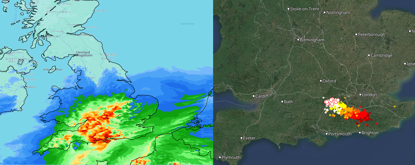
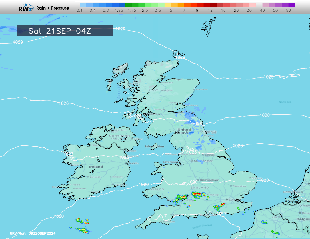
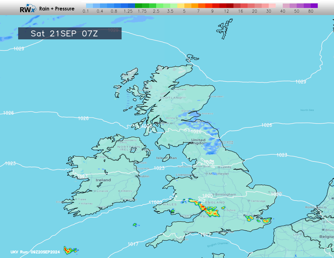
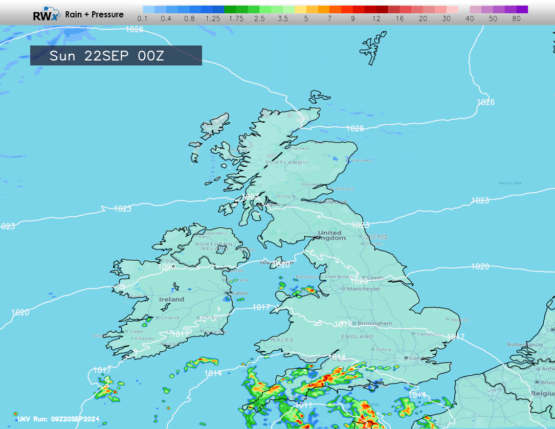
The main risk of thunderstorms during the next 24-48 hours will be across parts of Southern England, Wales and South-West England, however, we may see some thundery downpours developing across the Midlands and more central areas through the early hours of Saturday morning, moving into parts of Wales, with the risk continuing throughout Saturday and Sunday.
The storms, particularly during the heavier ones, will bring frequent lightning and localised flash flooding.
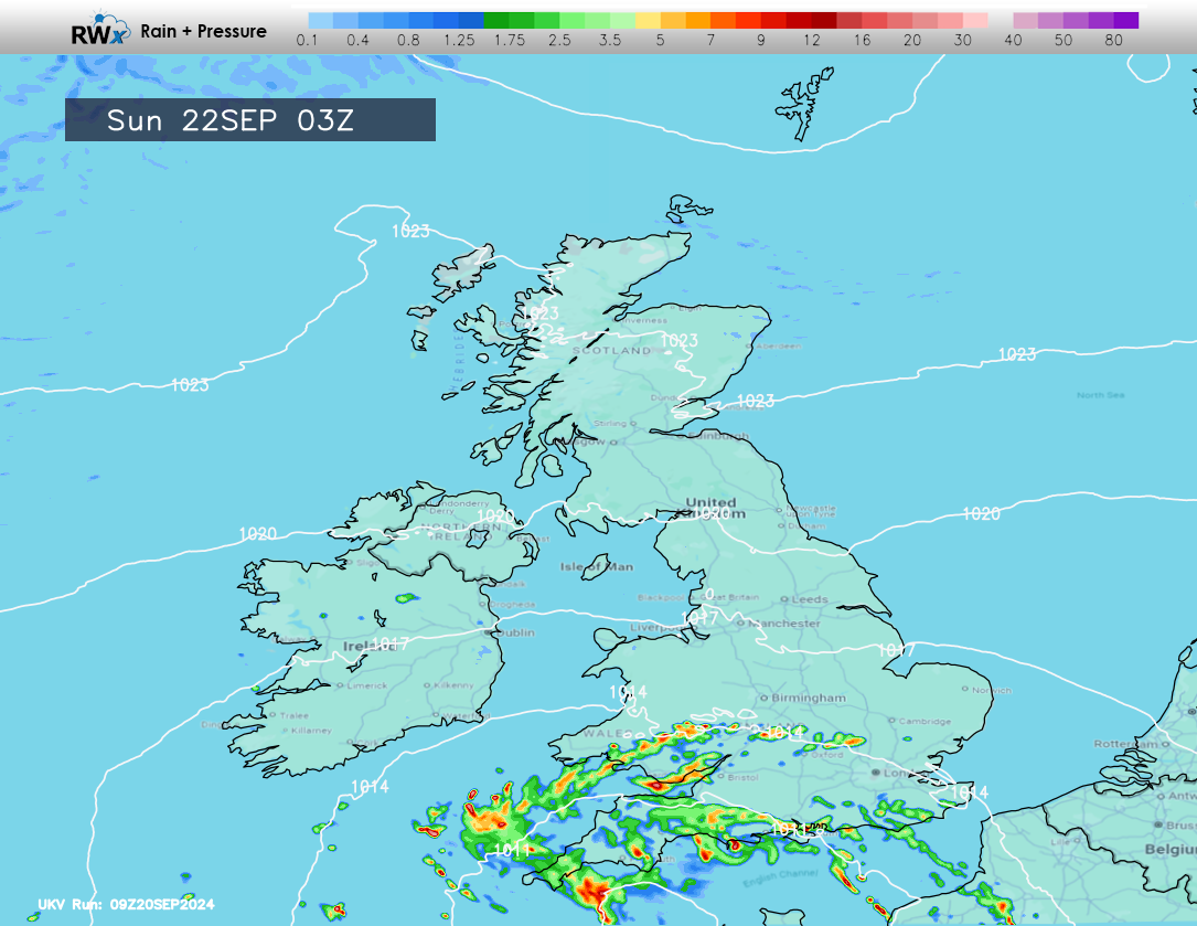
On Sunday morning (early hours) we see the area of low pressure move slowly northwards introducing a general area of rain across southern, southwestern and western parts of the United Kingdom.
We may see further embedded thunderstorms as the system moves in. A further batch of rather heavy rain with possible storms moves into parts of the south and south-east on Sunday afternoon.
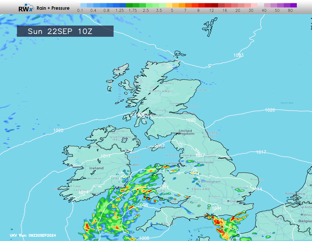
The area of low pressure and associated rainfall will slowly move into NW England, Yorkshire, Lincolnshire, Midlands and parts of East Anglia through Sunday and into Monday, becoming slow moving and eventually pulling away into Tuesday!
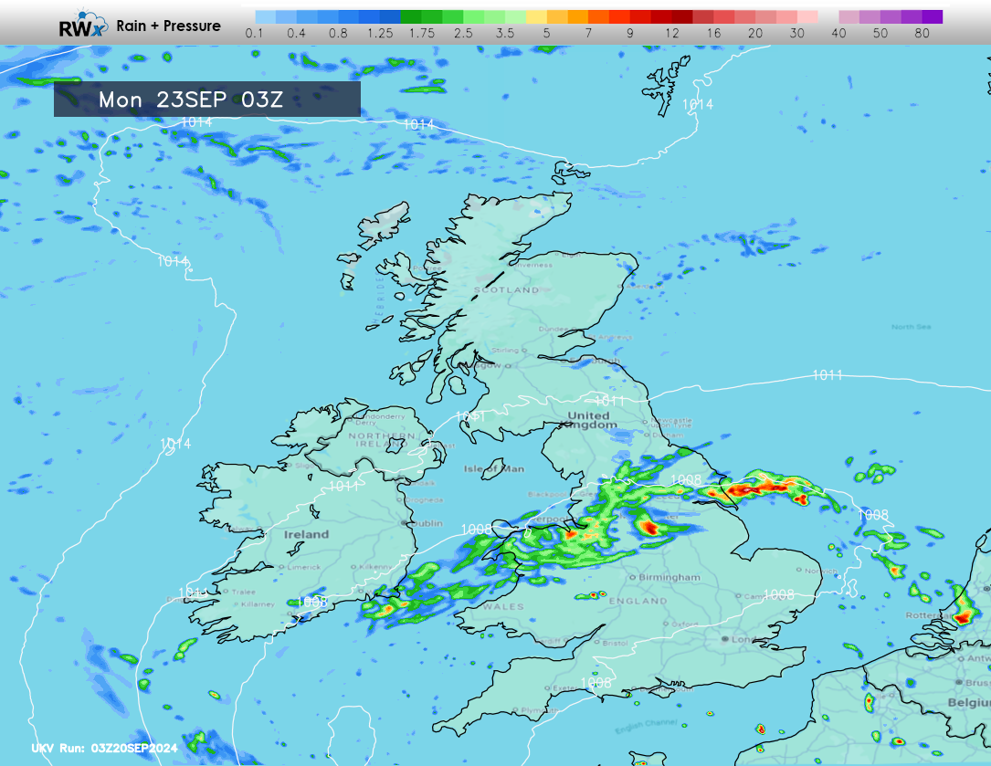
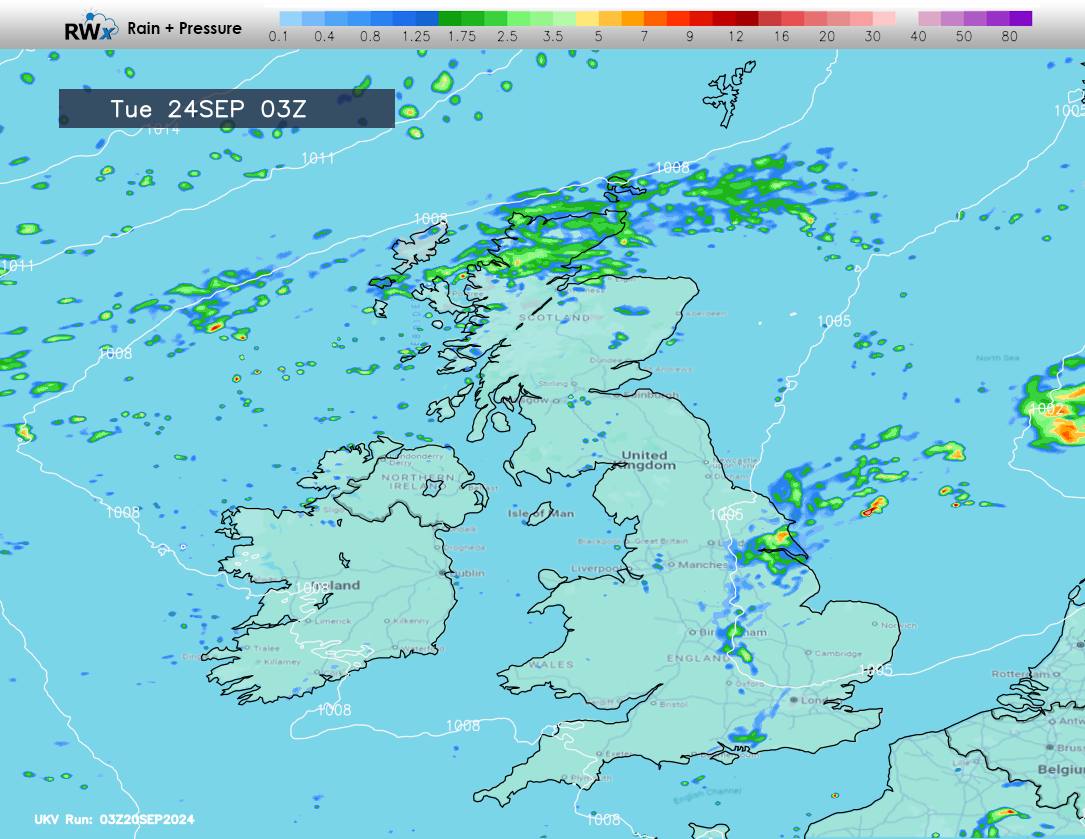
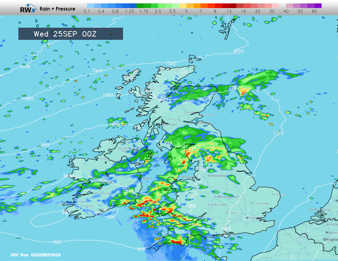
By this time, we’ll see wet weather from another system moving into Scotland, introducing fresher conditions in behind, before we see another area of low pressure move in from the south-west later Tuesday. We will see a rather wet spell of weather from this system, for many areas!
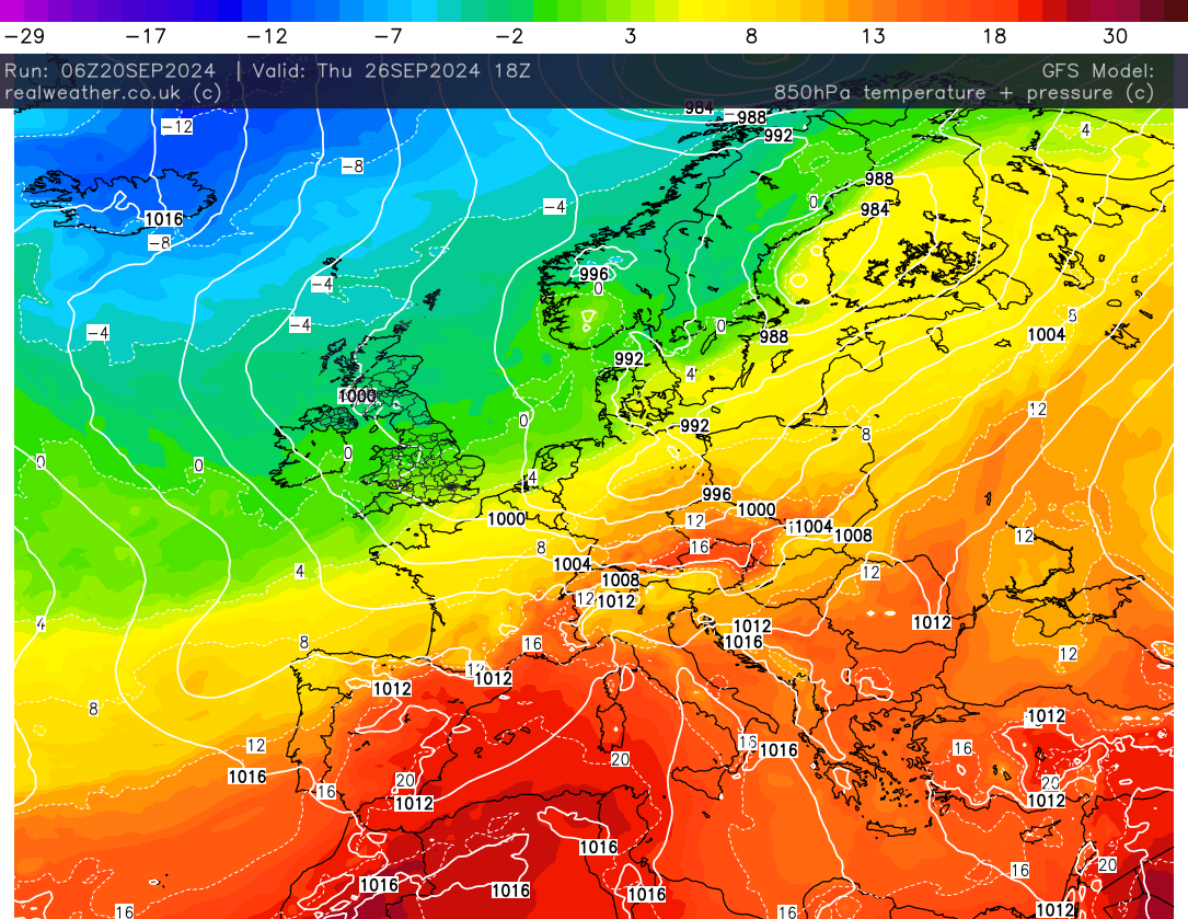
As Wednesday’s system clears away to the east of the United Kingdom, we’ll pull in a cooler north to northwesterly flow. The cooler air introducing overnight frost risks for some of us with some wintry precipitation over the tops of the Scottish mountains.
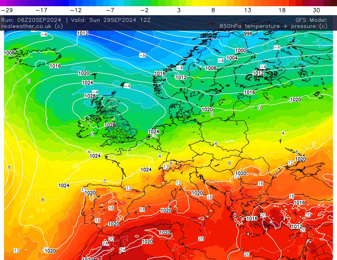
By next weekend, high pressure, albeit temporary, will position across the UK and with cooler air aloft, under clearing skies, we’ll see a greater threat of widespread overnight frosts.
So certainly a lively weekend to come if you’re in the southern half of the United Kingdom, but please keep in mind that not all areas in the risk/warning area will see thunderstorms. Next week is changeable with some wet weather for all, before cooler and generally more settled conditions move back in. I’ll keep you updated as always on the social media pages.
Lewis