
There has been talk from the usual tabloids over the last few days about very warm weather and heatwave conditions on the way next week and extending into May.
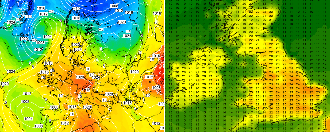
The models have been hinting at some warmer air moving out of the near continent and pushing into the United Kingdom, potentially bringing temperatures of 20-24c, some models are even showing 26c, at least into the southern half of the United Kingdom next week.
Firstly, there are absolutely no certainties. Whilst most models are hinting at the possibility, they’re a bit up and down with the pattern and whether we get the warmest air into the United Kingdom and certainly whether or not it lasts.
The attached chart from the ECM model would more than likely lead to the ‘warmest’ initial temperatures based on the overall pattern, however it wouldn’t last. It has low pressure sat just to the west of Spain and Portugal with warmer air then pushing up from the continent.
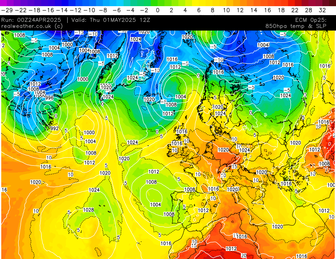
As a result warm air would then move into the United Kingdom for a time, bringing warmer temperatures.
However, the low to the west of Portugal/Spain then pulls away away to the south and high pressure then starts to build just to the west of the United Kingdom.
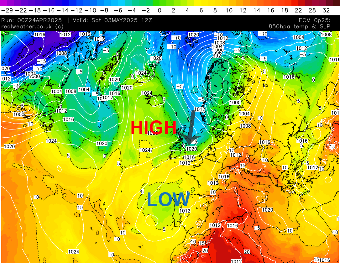
This would essentially stall the progress of warmer air from the near continent and with high pressure then migrating unfavorably and low pressure by this time across Iceland slipping into Scandinavia, we would then likely draw in a cooler northerly flow with any ‘warmer’ flow being cut off and shunted away from the UK, replaced by cooler conditions.
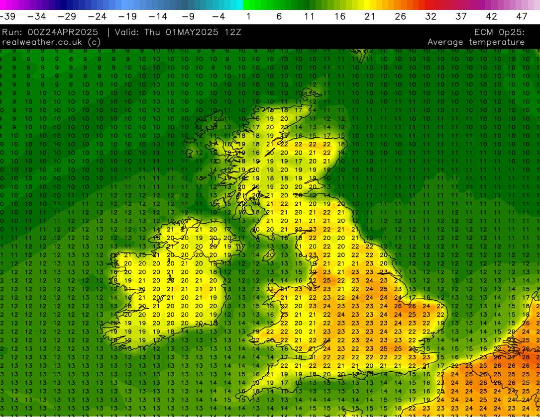
However, before this happens, we should see 3-4 days of much warmer temperatures, around the 21-24c mark, with perhaps some spots pushing 25c. As shown on the image below from the ECM model, showing average day-time temperatures, for next Thursday.
Taking a look at another model, being the GFS, we see a different pattern in the output. Instead of the low pressure sat to the west of Spain and Portugal slipping south, it tracks north/north-west and moves into the Atlantic.
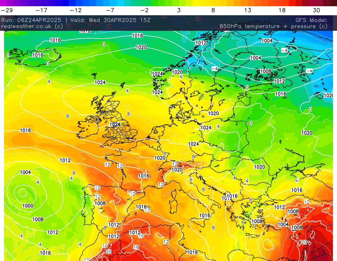
This then stops high pressure setting up in the ‘wrong place’ and instead of high pressure establishing to the west of the United Kingdom in the Atlantic, it sets up across the United Kingdom.
As a result, the milder air gets further north and we are sat under a much larger high with warmer upper air being pumped into the high pressure from the near continent. This pattern essentially would ‘prop’ up the milder conditions across the United Kingdom and keep the warmer weather going longer.
If this occurs then plenty of dry, bright and warmer weather would be on the cards next week! So yes, it is turning warmer next week, but the longevity is currently in question. I’ll firm up on things over the coming days and let you know when I have exacts. Lewis.