Preliminary thoughts for UK Winter 2024/25
It is that time of the year, winter is just around the corner, hasn’t 2024 flown by! This time of the year everyone is asking me the same question, what will winter 2024/25 bring?
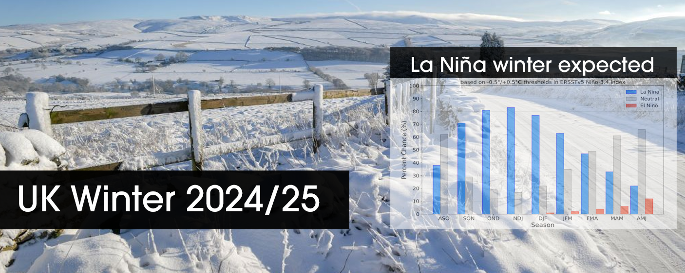
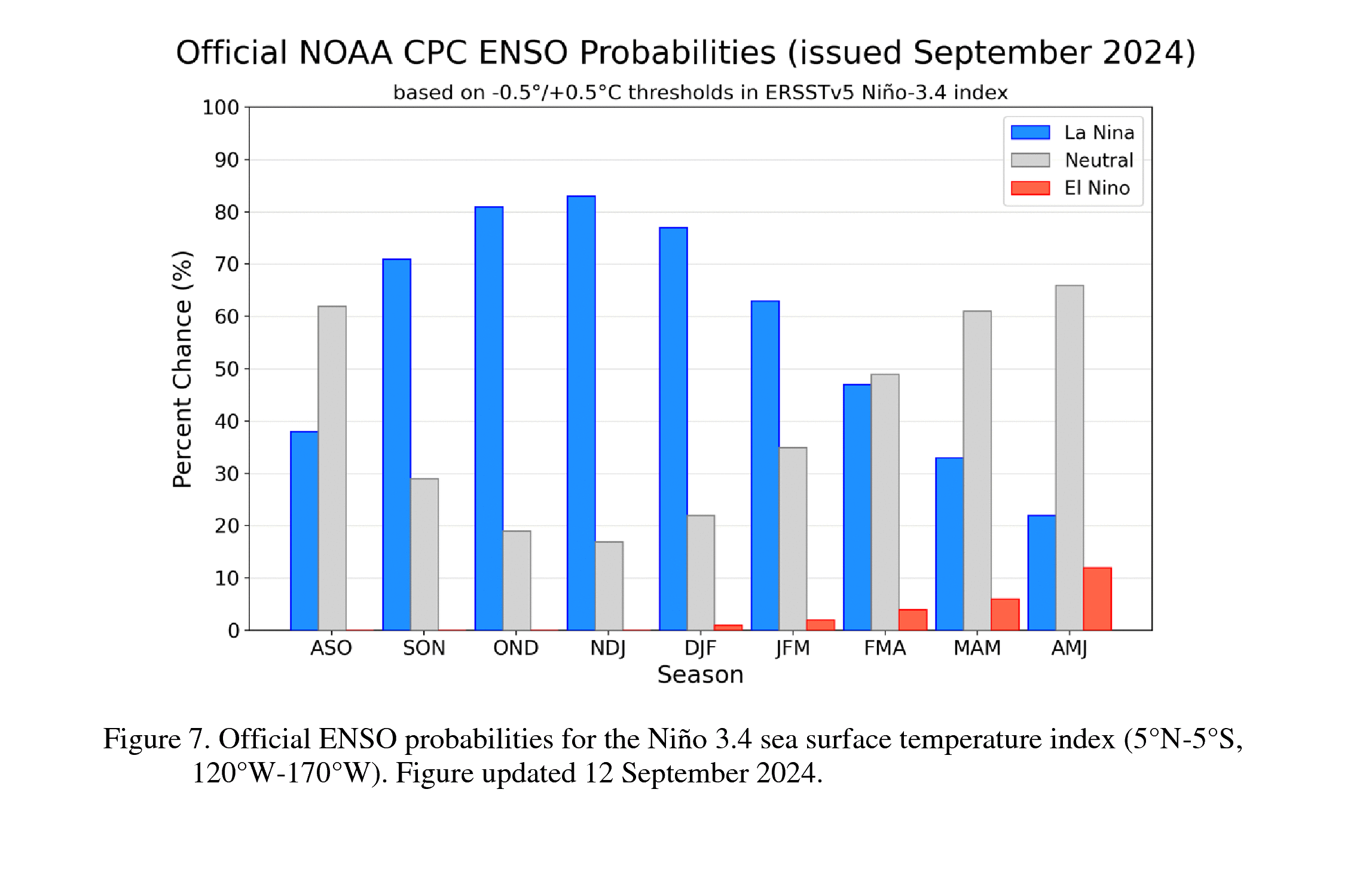
We’re expecting a La Niña UK winter 2024/25, going by the latest ENSO forecast from NOAA, a La Niña phase is more than likely to occur this winter. But what does this mean? Will it be a warm winter or a cold winter? See below.
La Niña phase but what does it mean for the UK?
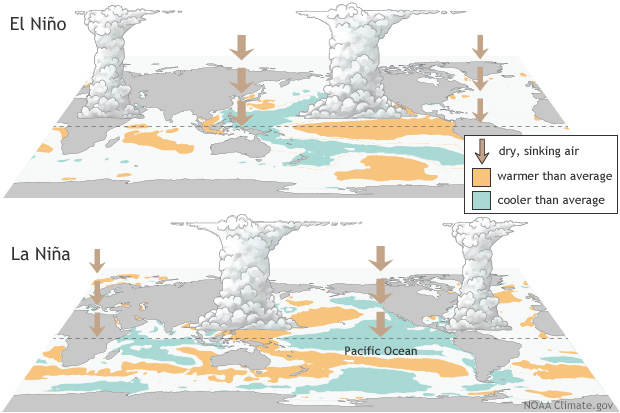
La Niña is one of the three phases of the phenomenon known as the El Niño-Southern Oscillation (ENSO for short). The three phases are El Niño which is the warm phase, La Niña which is the cool phase and the third phase is a neutral phase.
A La Niña phase typically brings stronger trade winds blowing warmer water towards the west Pacific, this then in turn causes cooler water moving up from the East Pacific leading to much more varied weather conditions globally. This occurrence does have a direct affect on the UK’s weather, it can also at times significantly affect the jet stream, which we all know drives our weather to our beautiful Island!
You may have seen my post a few weeks ago highlighting that the start of Autumn, at the very least, will be rather quiet in terms of Atlantic systems (areas of low pressure), with higher pressure dominating at times.
This is what we typically see here in the UK during a La Niña phase of the ENSO. High pressure in the Mid atlantic or situated over Scandinavia, stalling Atlantic systems. This then promotes colder air into the UK and may even increase the risk of much colder spells of weather developing further down the line as Siberia and Europe cool down.
We’re currently seeing a similar pattern with our weather (week of 16th September 2024). We have high pressure in the right area, over Scandinavia, with a feed from the east or north-east. The only difference is that the upper air temperatures with this pattern are rather warm, so at the surface we’re seeing temperatures increasing throughout this week!
This pattern is rather typical for early autumn during a La Niña phase. It is also worth mentioning that during a La Niña phase, whilst the start and middle of Autumn can be rather quiet in terms of Atlantic systems, we usually see the Jet stream fire up into the New Year, so with that in mind, whilst we may see a much more settled and cooler October-December, January may be more changeable!
Will winter 2024/25 be cold?
My current expectations for UK winter 2024/25 are that we’ll see blocking high pressure dominate at times with an increase in colder spells. Northeasterly and easterly occurrences will be more frequent than previous UK winters.
- – An earlier than usual start to winter conditions
- – Frequent frost/icy conditions compared to last winter
- – Increased spells of snow compared to previous winters
- – A milder or more varied second half of winter possible
I will issue the full winter forecast by the second week of November, to keep up to date regularly, join my pro service by clicking on the image below. You gain access to my Pro Facebook group that is behind closed doors, Android app, native IOS web app and lots of juicy weather data and features. There is a special offer for new users currently.